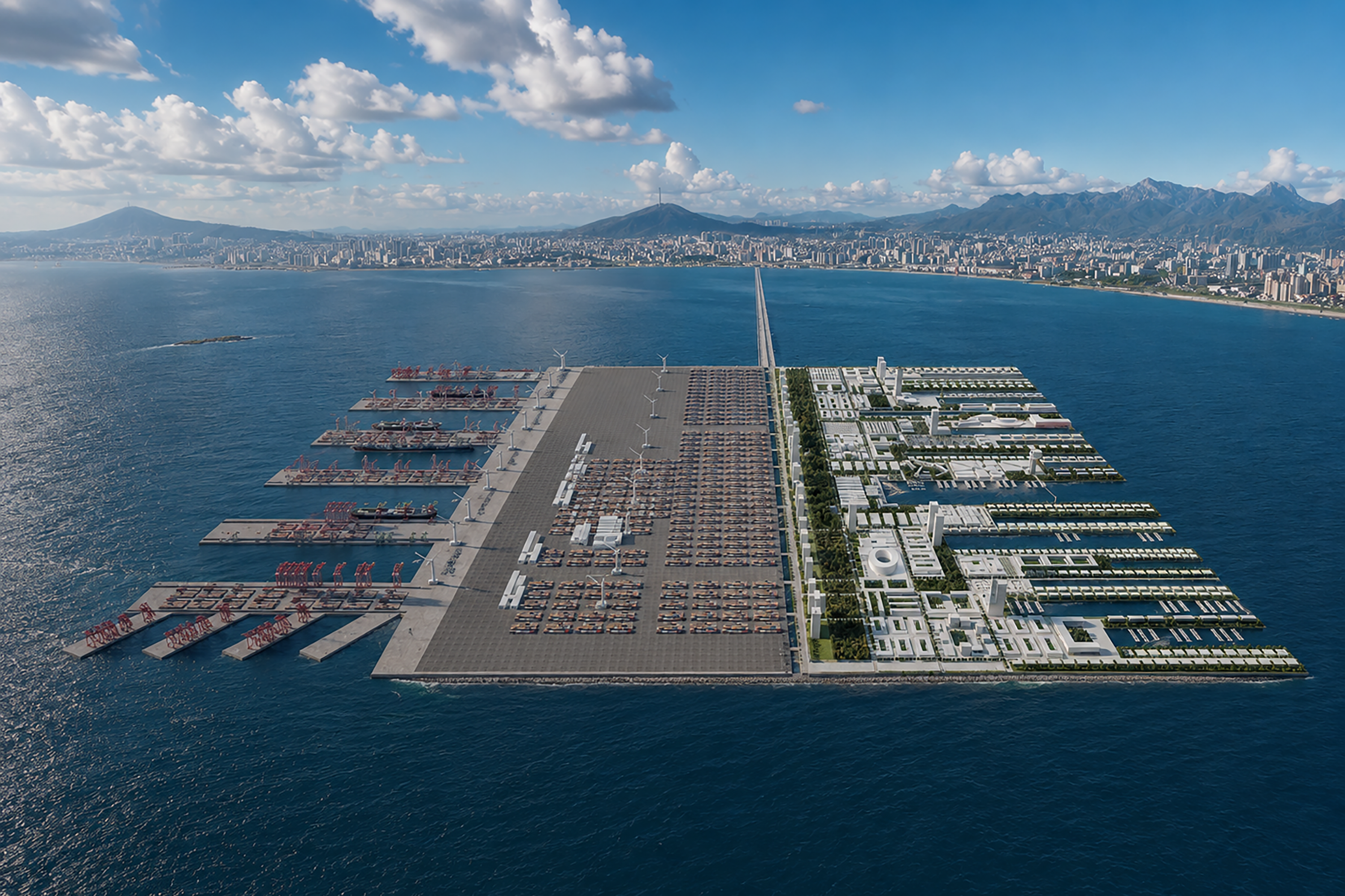
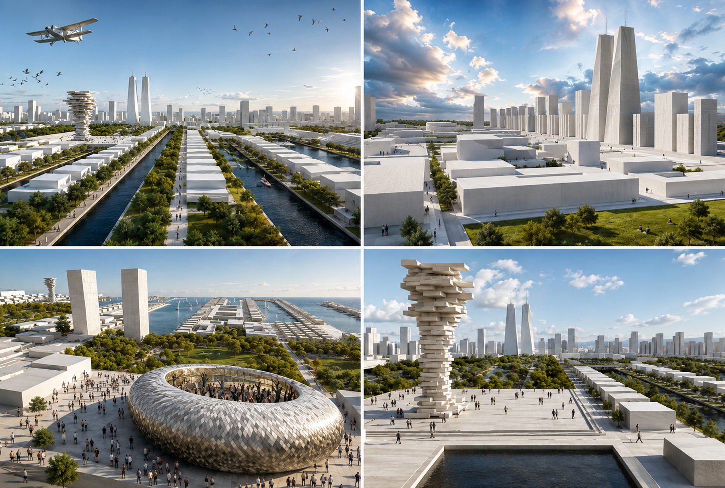
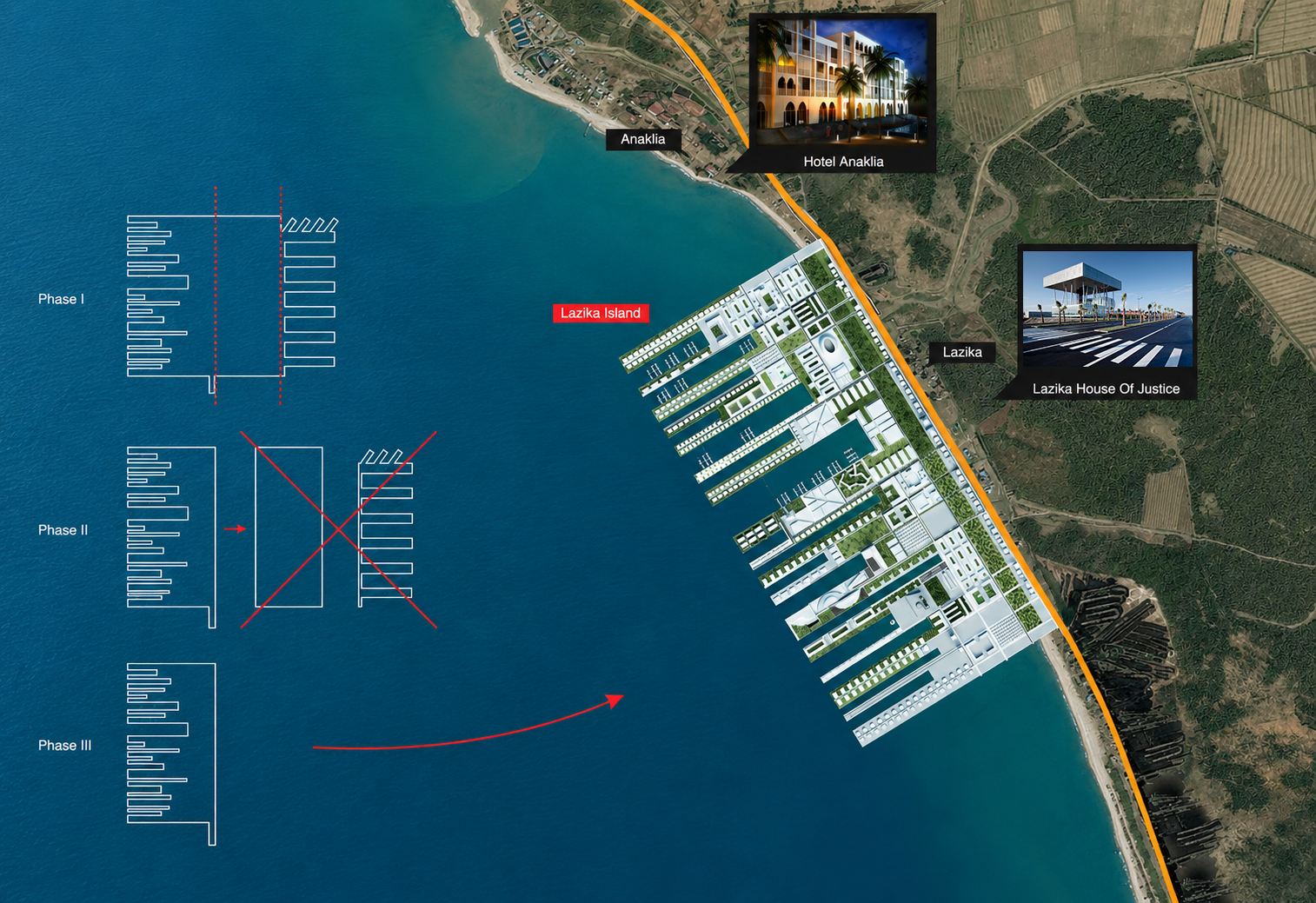
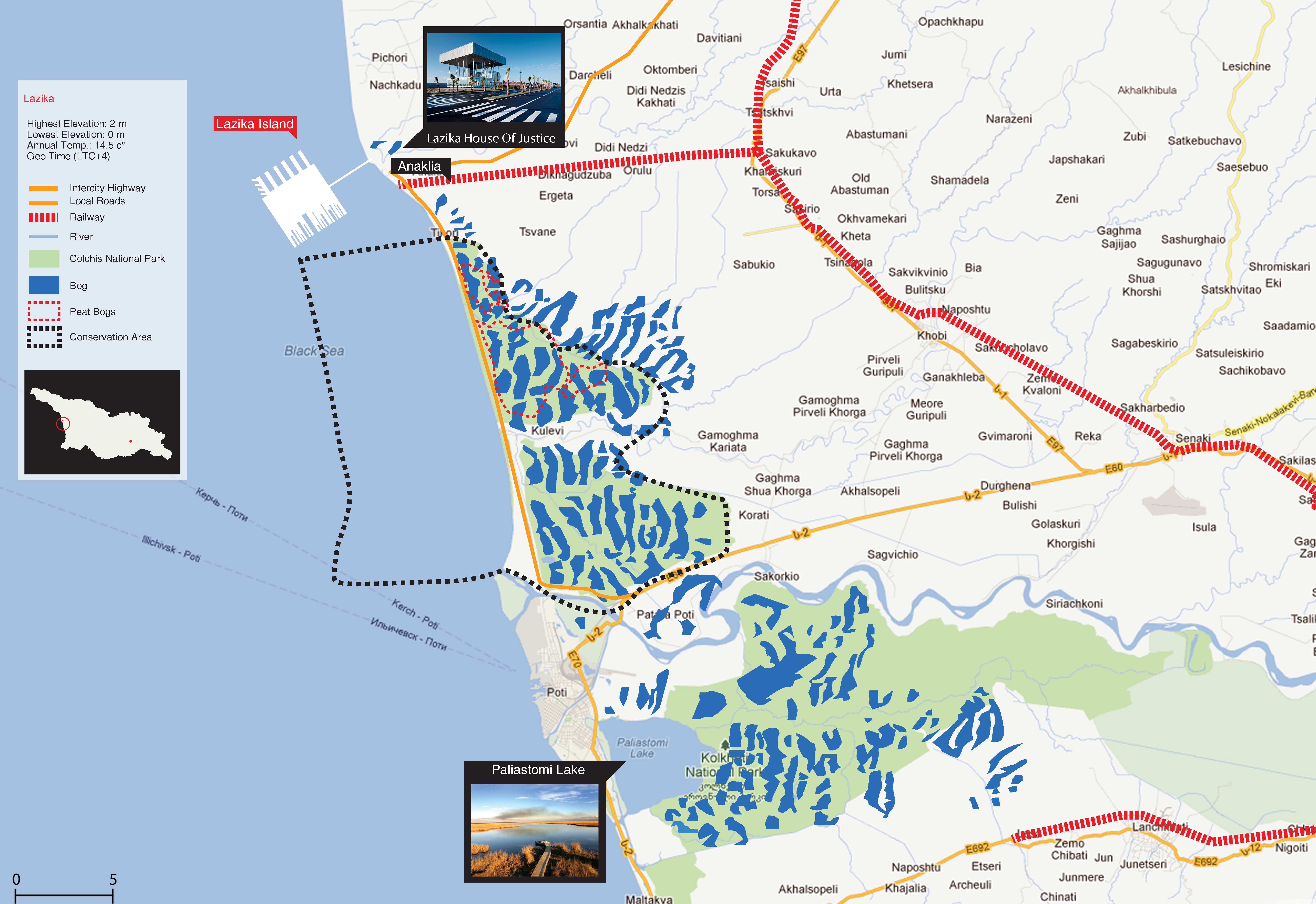
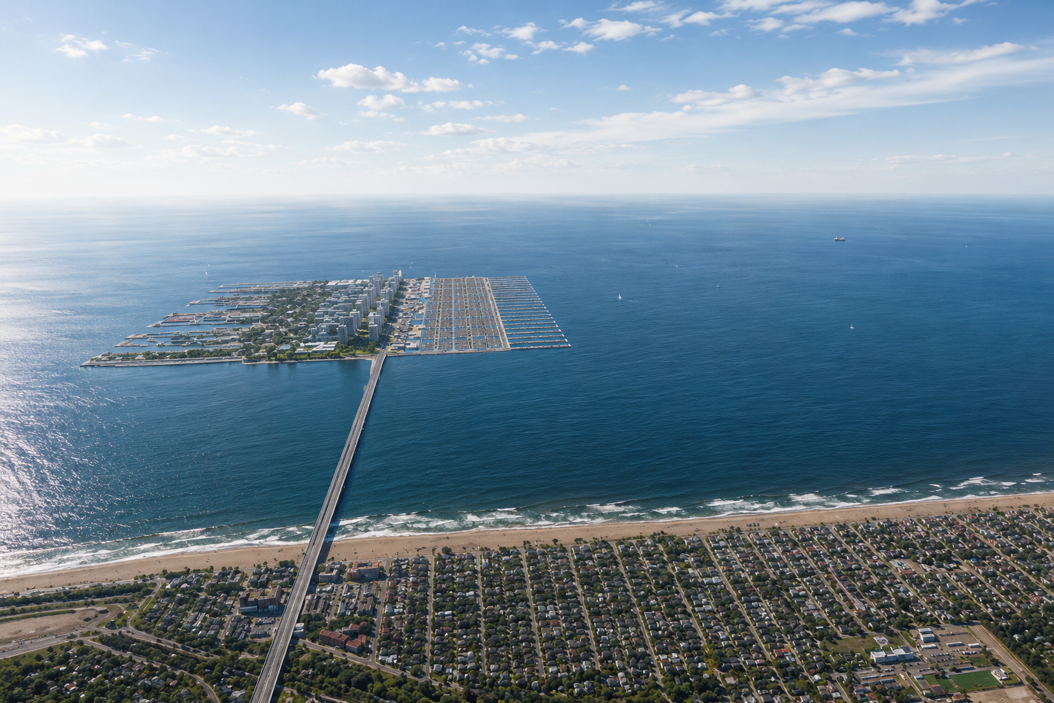
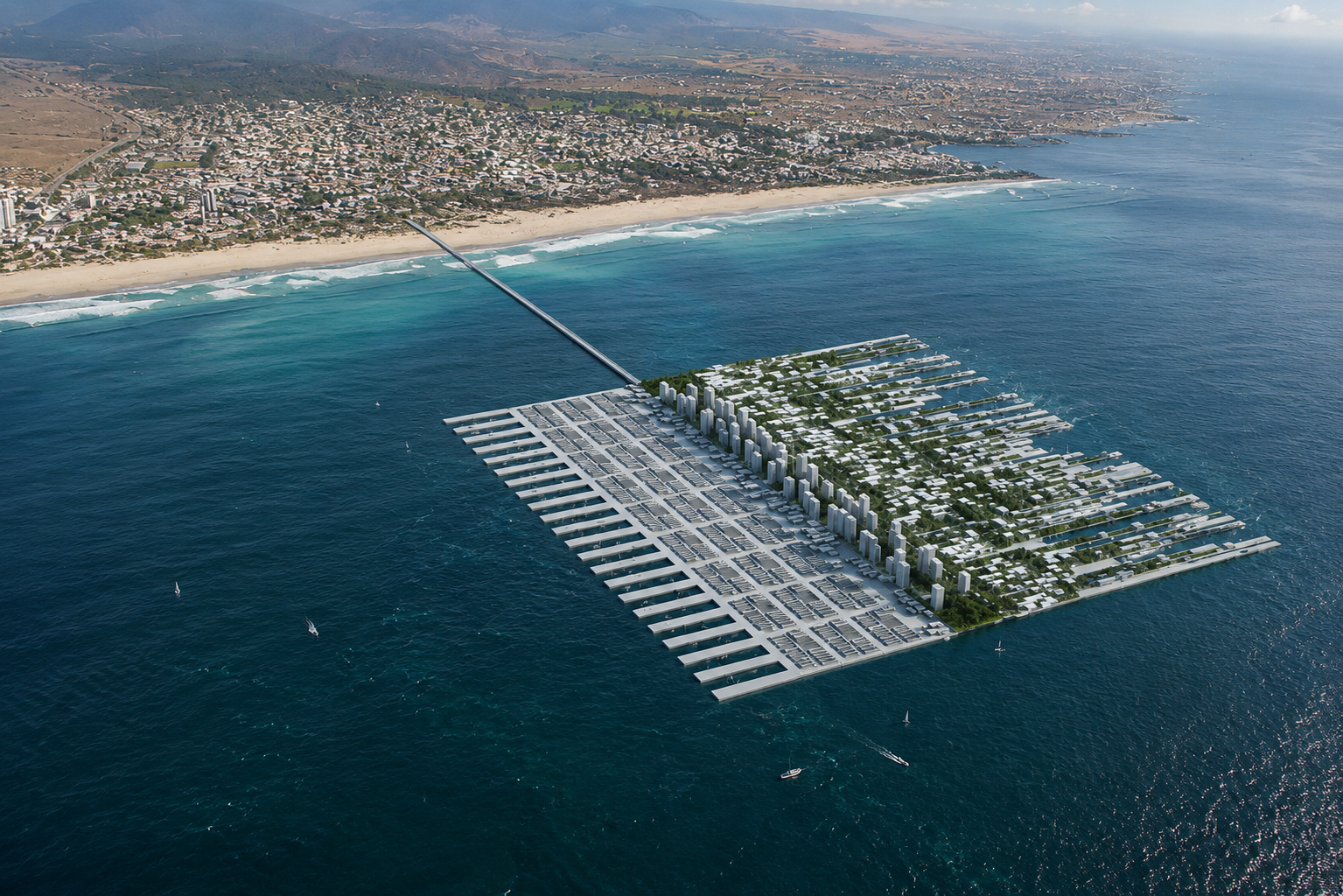
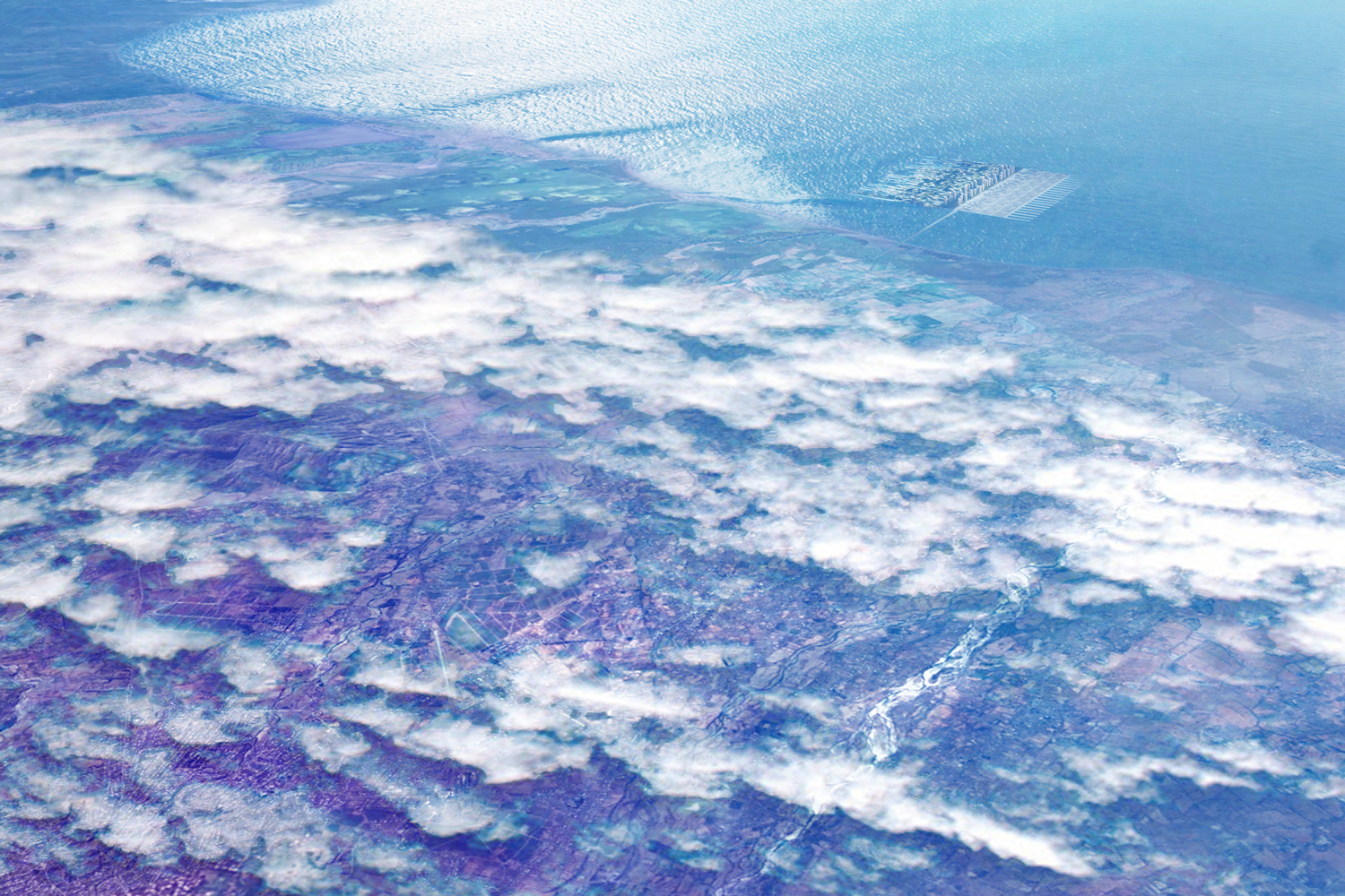
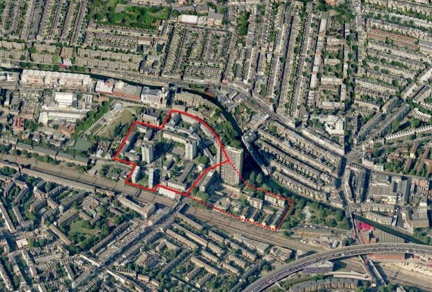
Anaklia Port Island is a largest port city in the Black Sea region. It is an artificial land mass located in the territorial waters of Georgia. It is a full scale international port with per year container and pulverulent materials capacity. It is located in 3 km from the coastal line with single bridge road connecting the main land, 5 km from Poti, 3 km from Anaklia and 9 km from Batumi. It's size is 3x3 km defined by the size of the port.The proposed island is designed to minimise impact of development on coast line, thus preserving the natural landing spot on bird migration route. The island is an alternative solution liberating the proposed land for the city of Lazika. Diverse programming, careful phasing and strategic priorities to uncertainties and change; fixed and variable condi-tions; complementary rather than competitive contribution to the use of the island.
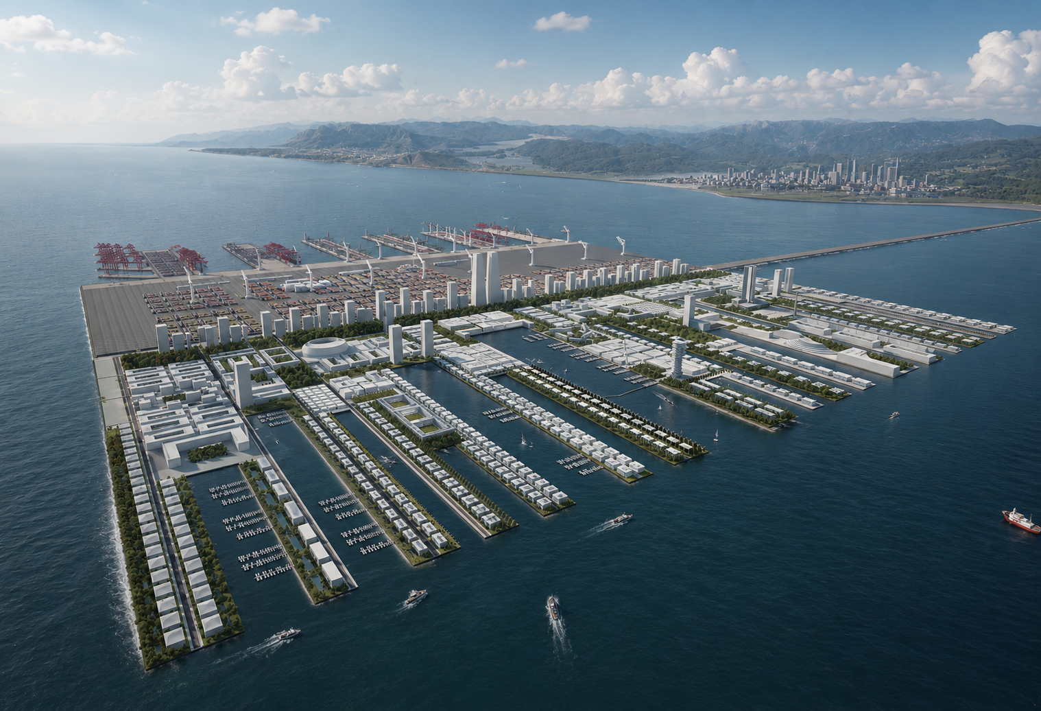
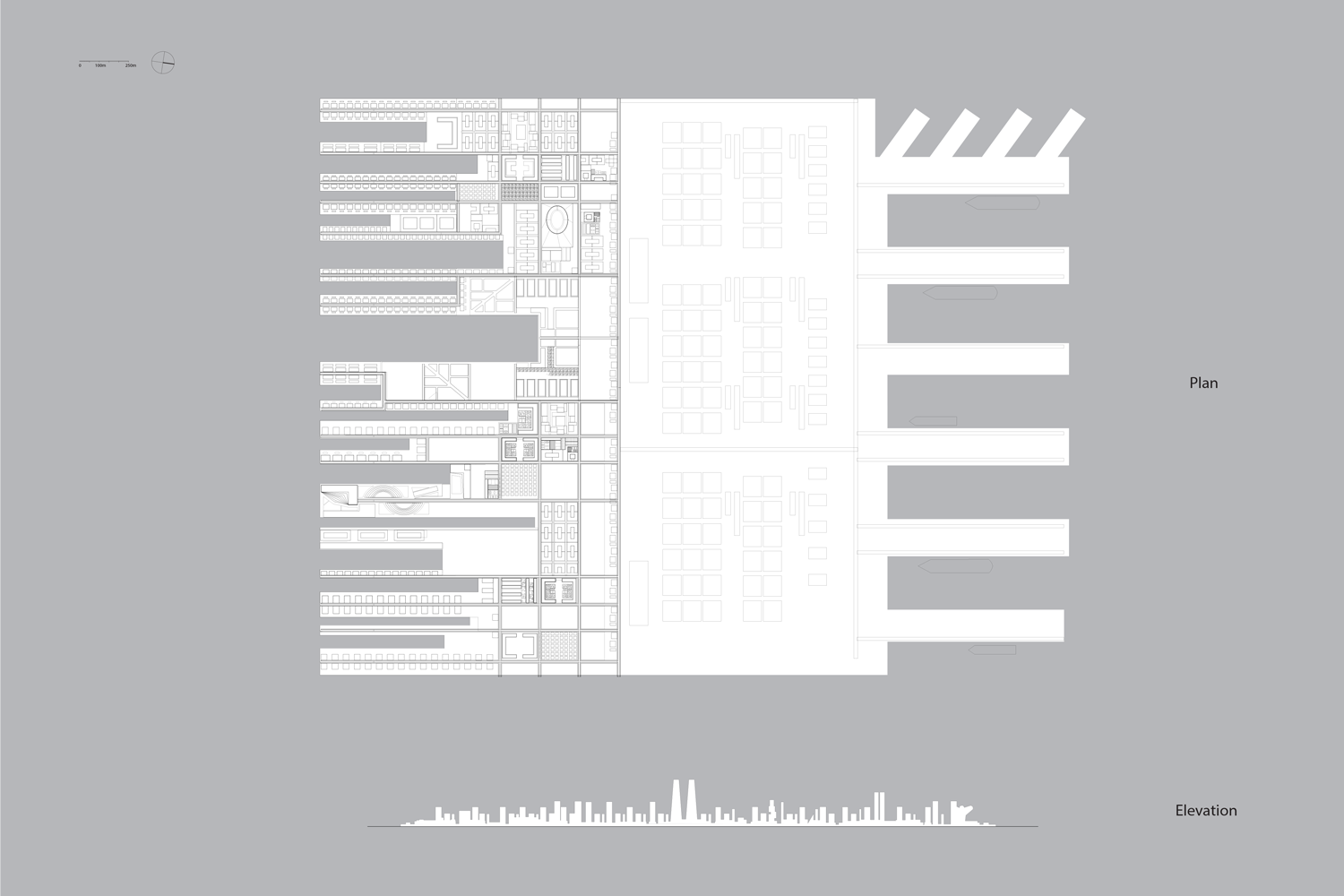
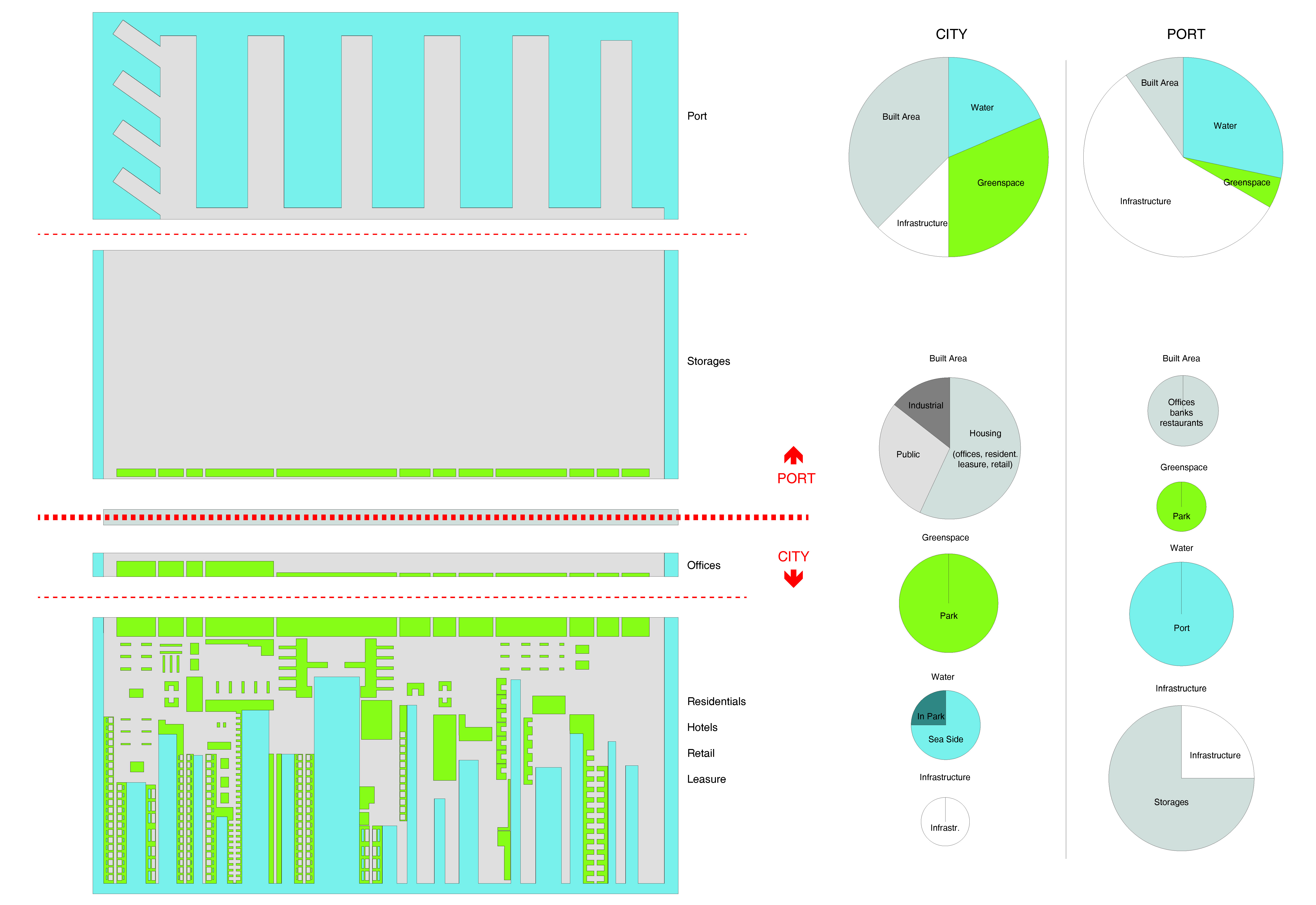
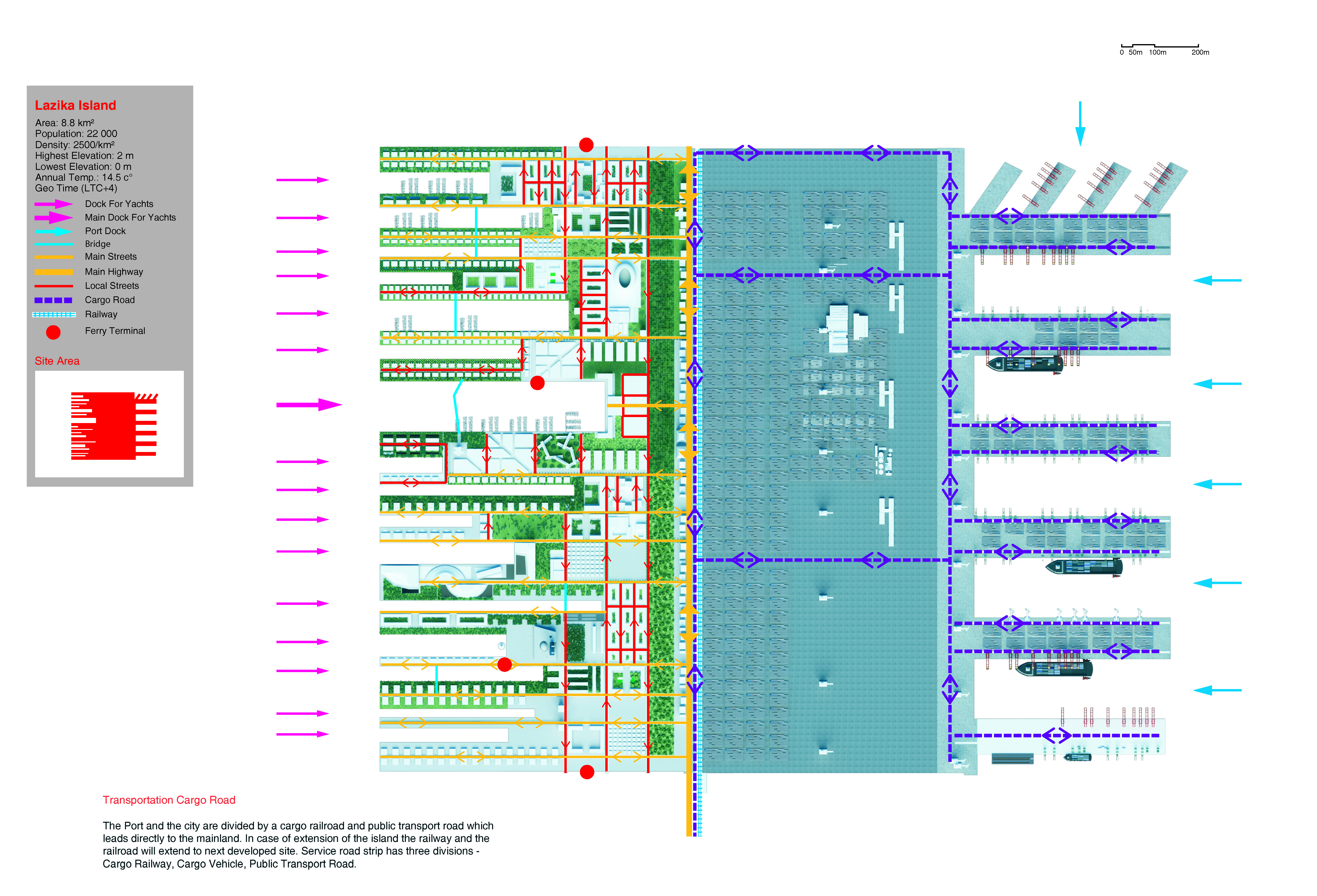
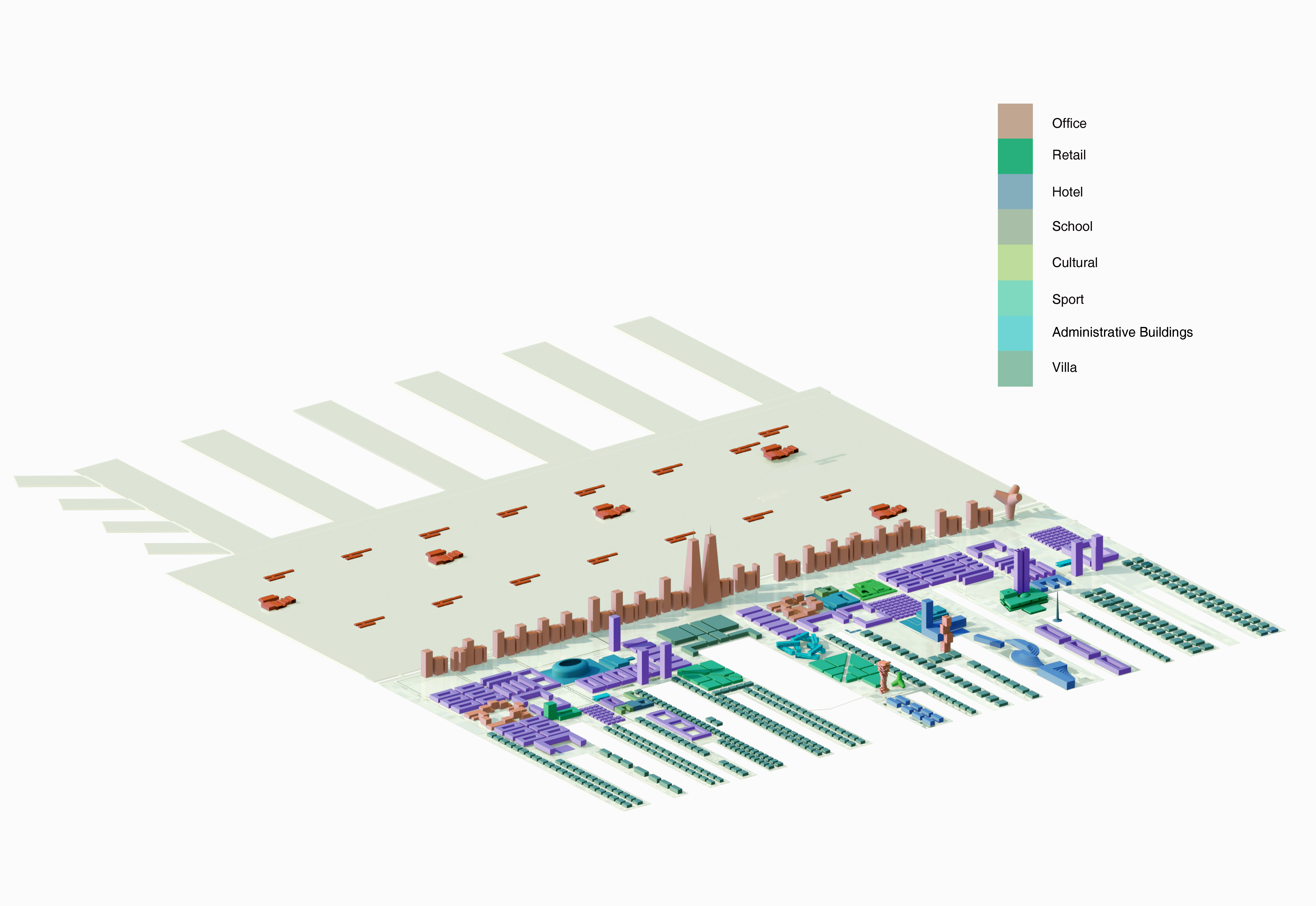
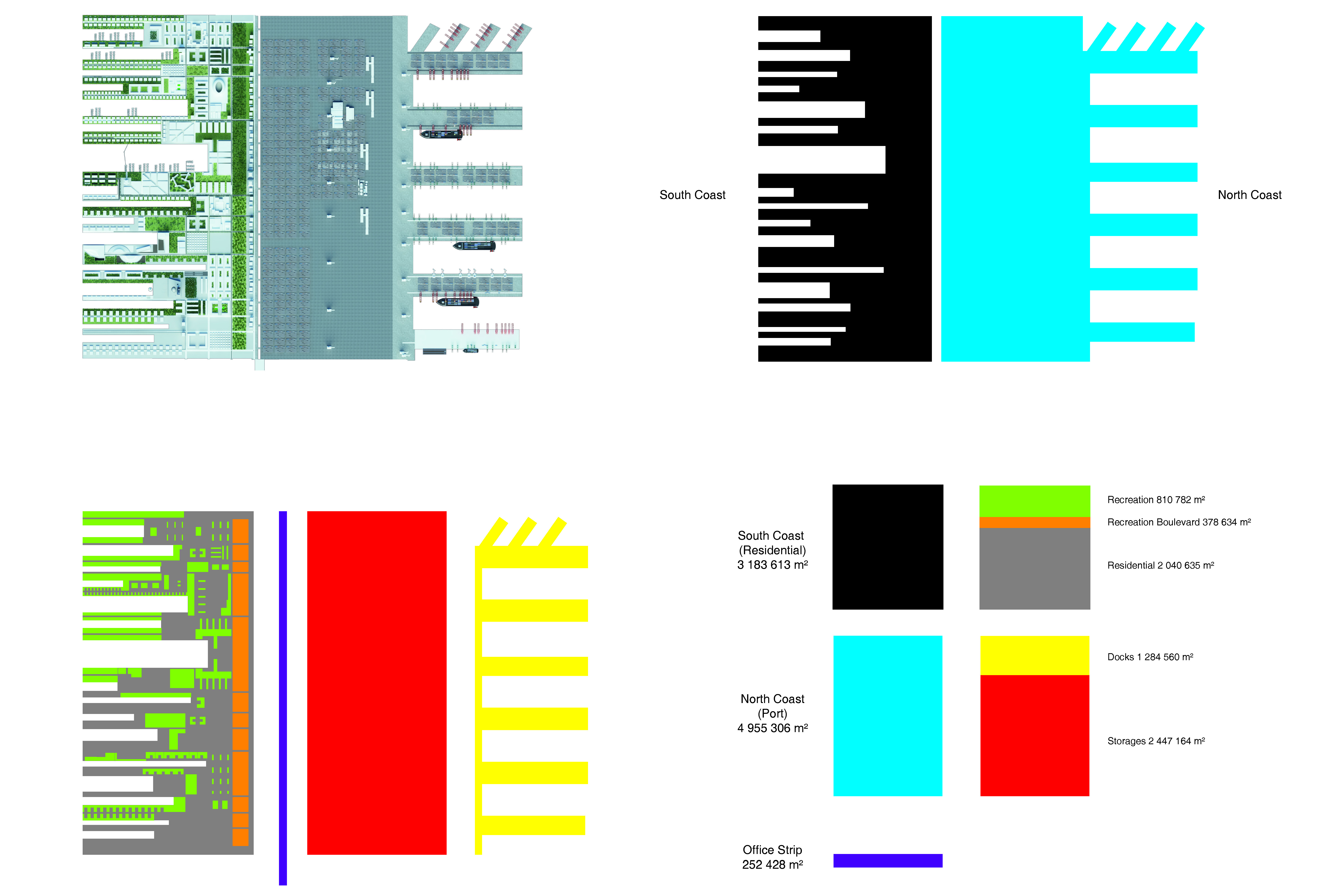
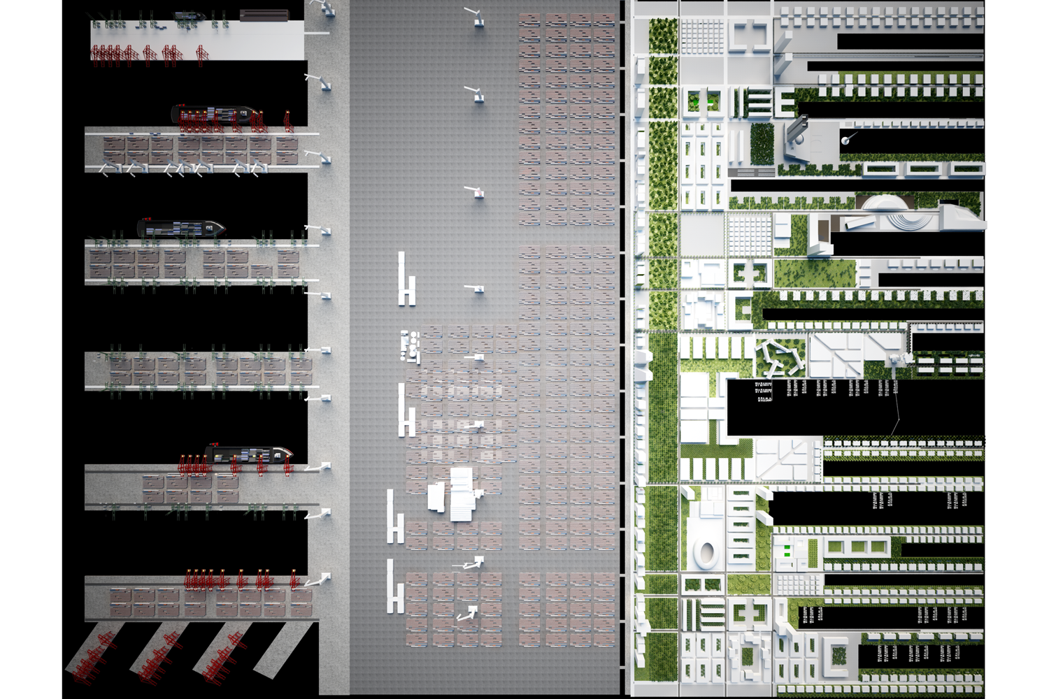
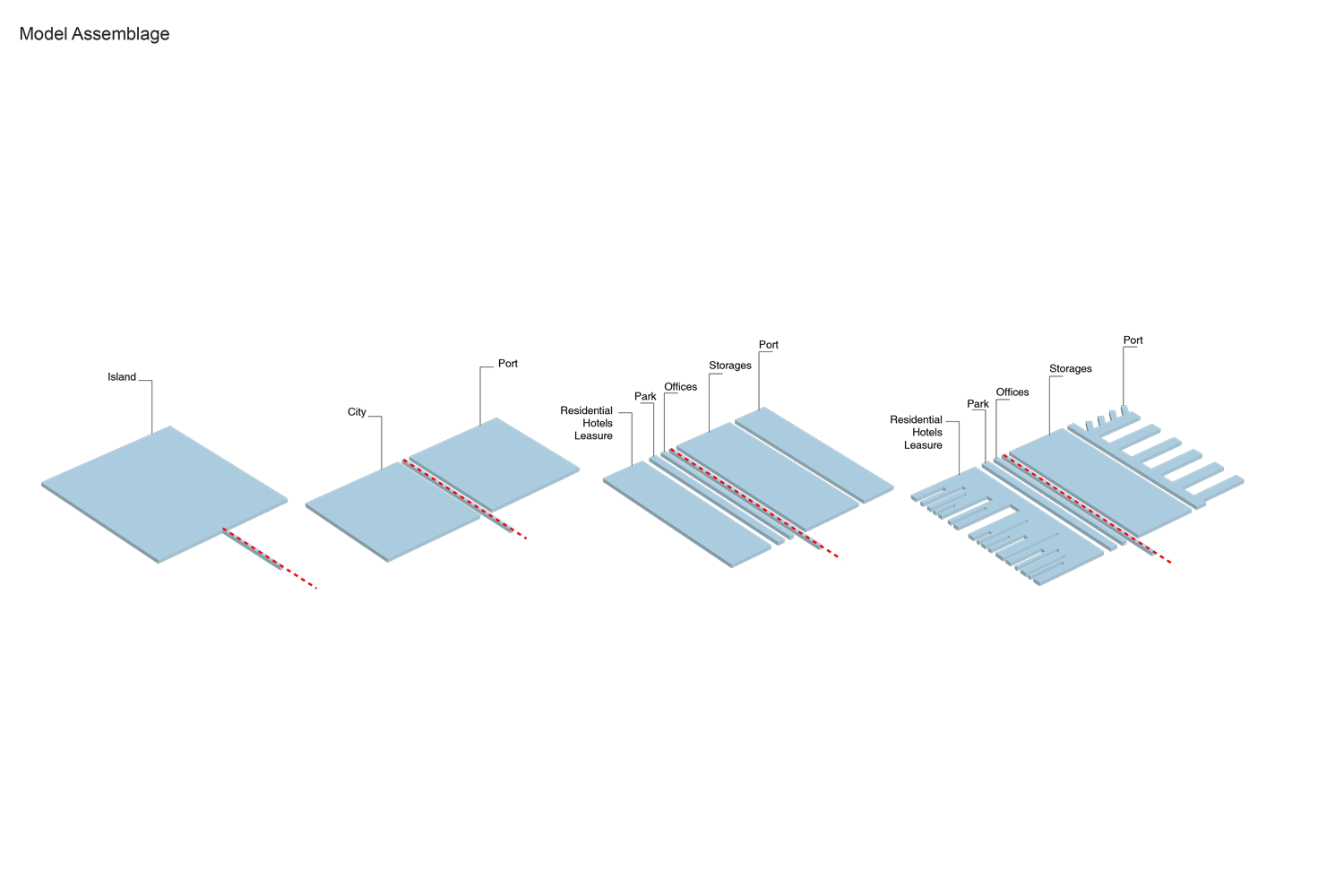
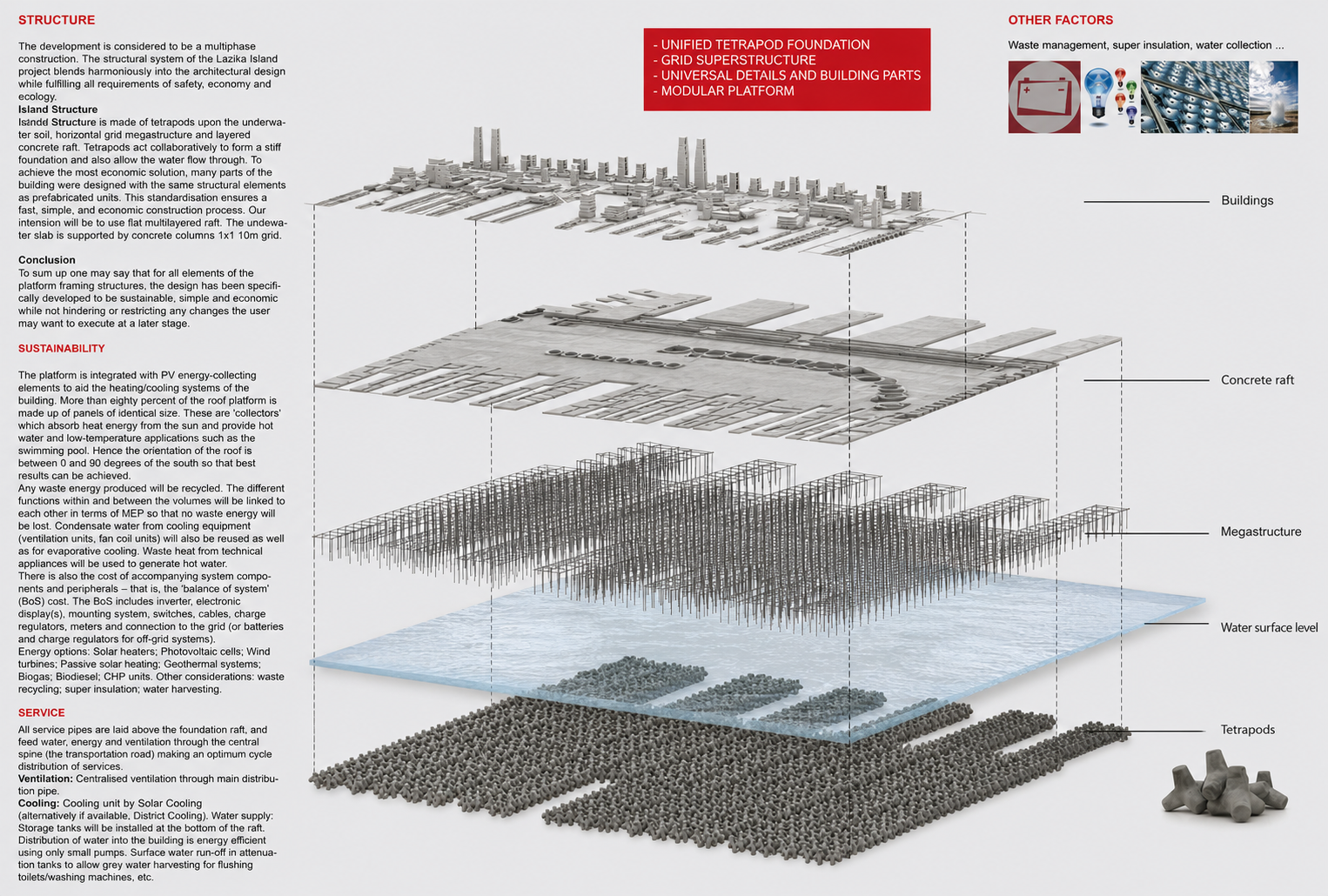
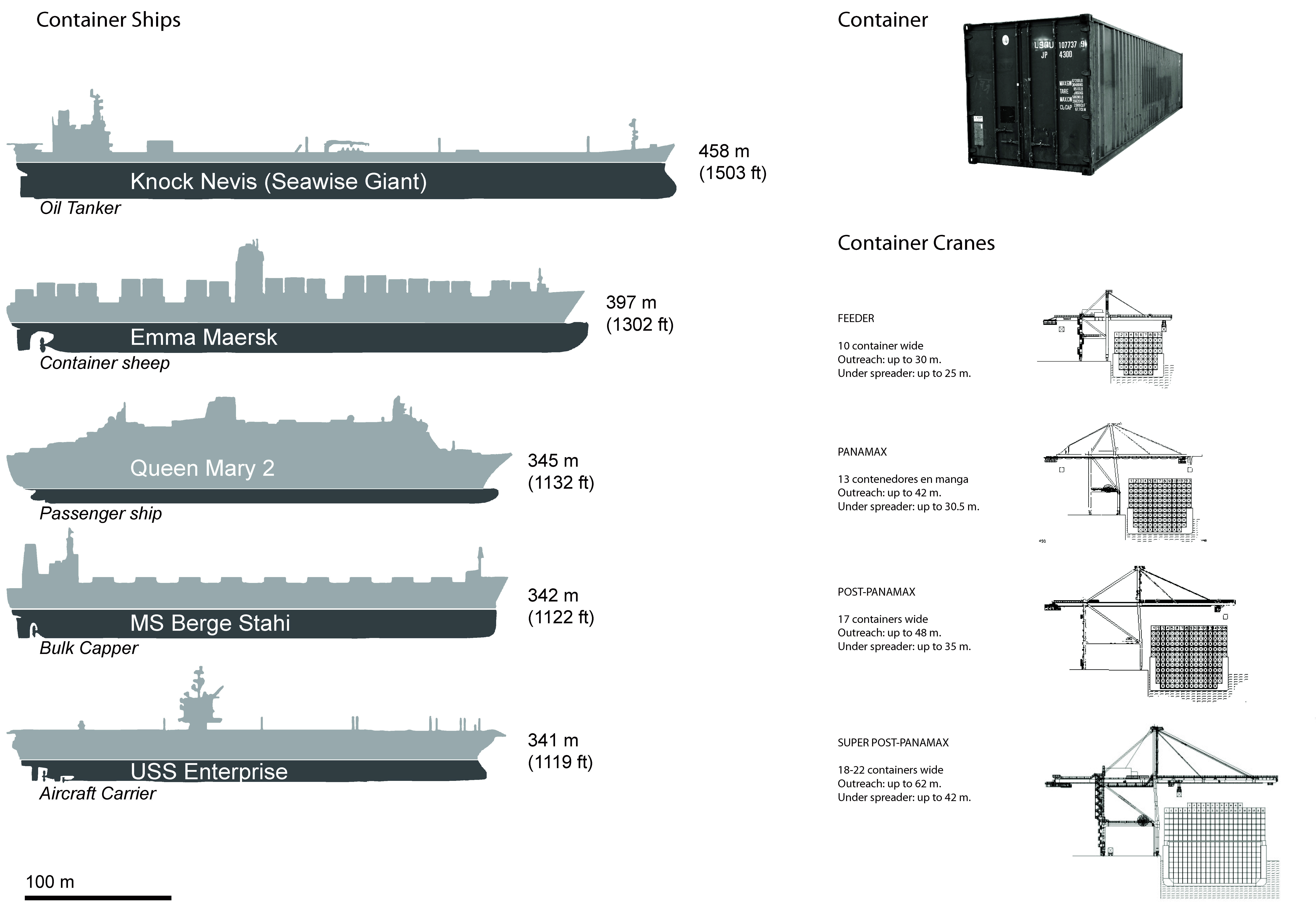
This condition of isolation and hyper connectivity to a larger context sea offers a new freedom in its relationship to the mainland. Its super rational -logic of artificial land use, infrastructure and internal organisation.Lazika Island is a metabolistic data structure. It is a sole urban body with defined function which informs diversity of the whole organism. Island's urban data is based on 300m grid making morphology as easy accessible by foot as extensible on demand each module of 300x300m of the grid can be added to the plot. The rail cargo road divides the island in two 1.5km equal parts - port and the city.The Port and the city are divided by a cargo railroad and public transport road which leads directly to the mainland. In case of extension of the island the railway and the railroad will extend to next developed site. Service road, offices and a public park strip act as a buffer between two entities. The SiteSite is located in territorial waters of Georgia 1.5km away from the Black Sea coastal line. It is connected to the main land with a bridge road serving as public road and industrial railway and trailer road which is a sole connection point to the mainland. Site is 3x3km 9.000 sq. km. Sea depth at the distance of 1.5km from the land is 3km.
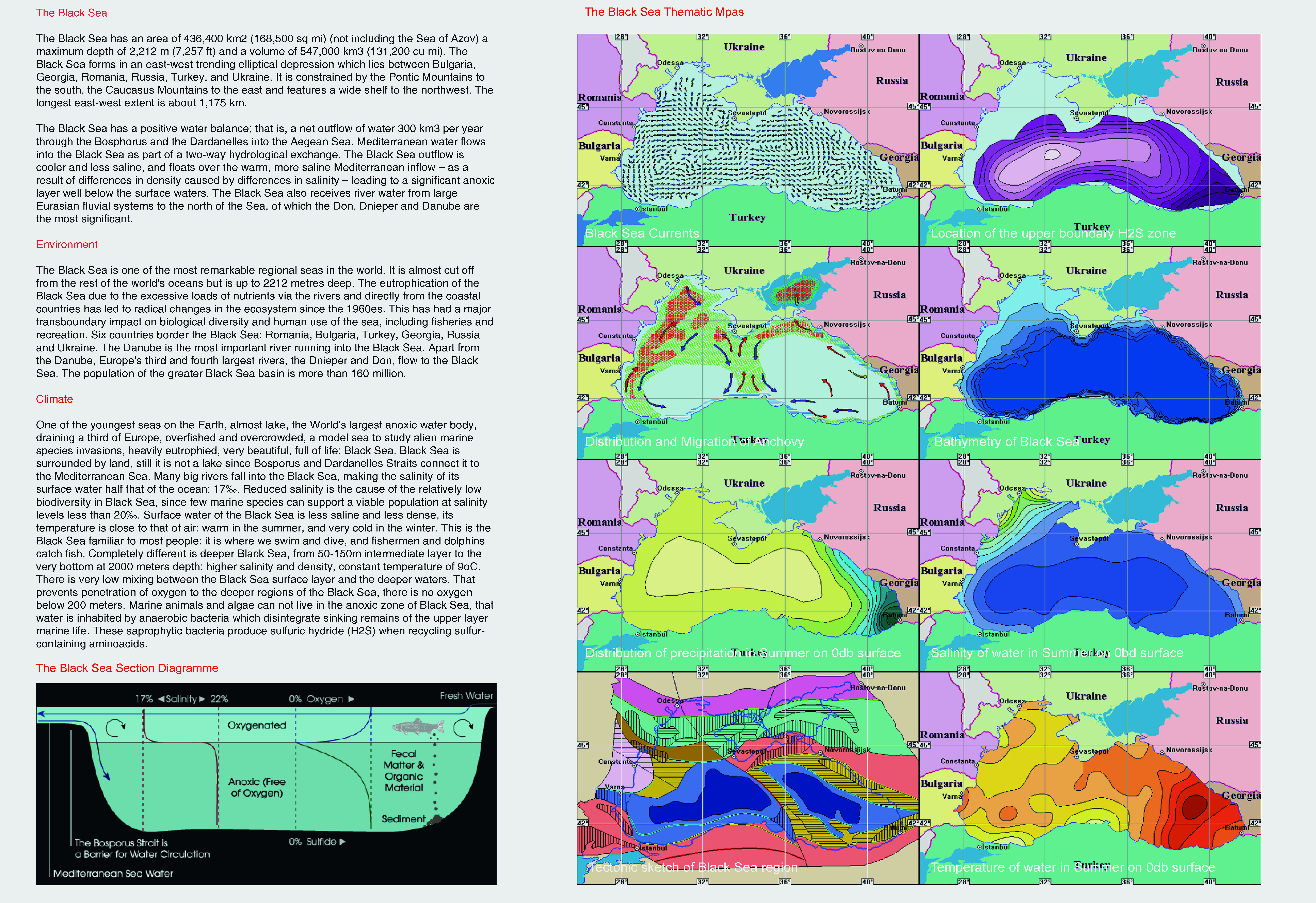
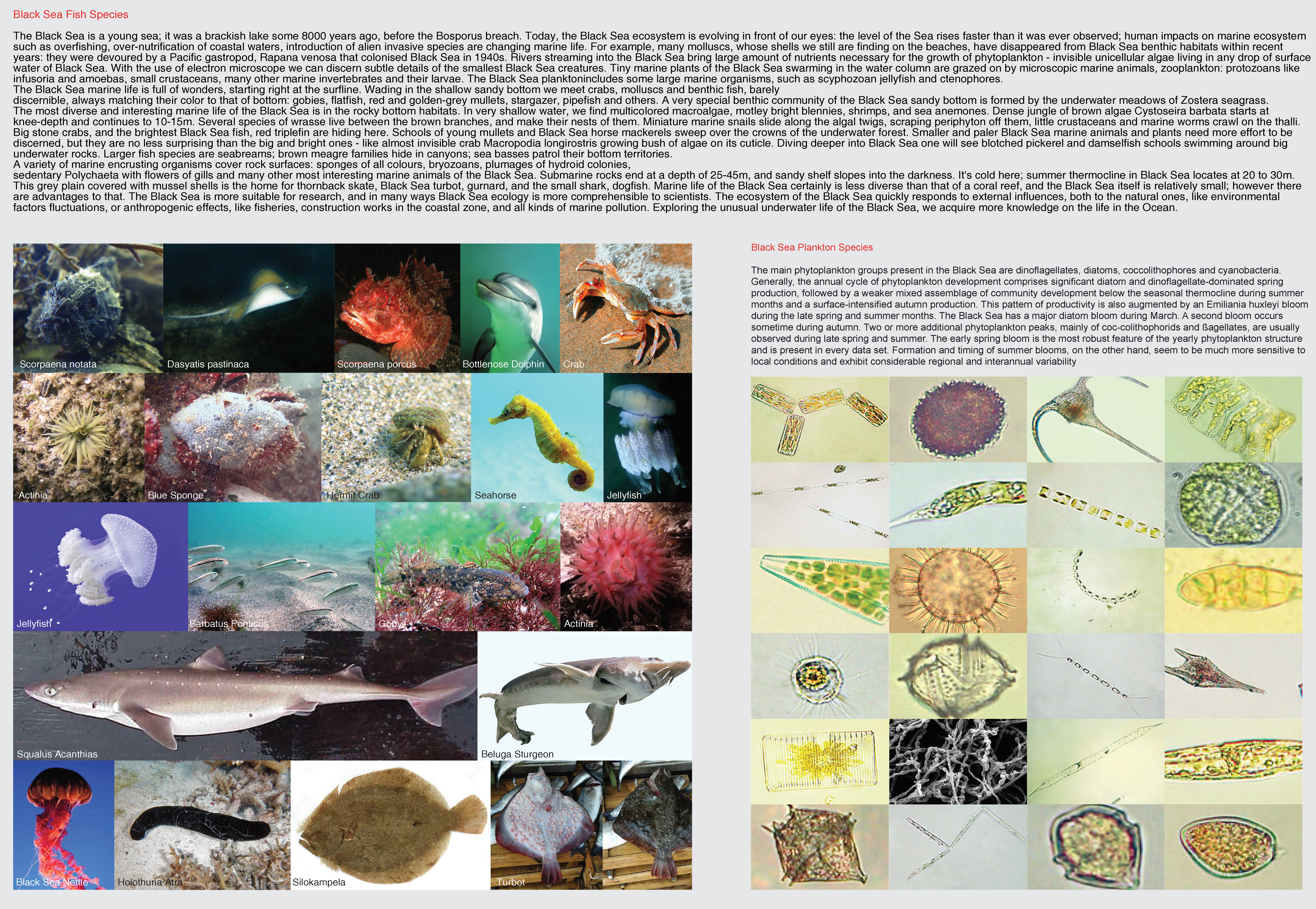
The Black Sea
Sea depth at the distance of 1.5km from the land is 3km. Sea depth at the distance of 3km from the land is decreasing by 12% which estimates about 50m depth under the site. The current is circulating from the south to the east.Main land Lazika has no urban tissue except of small village with 800 inhabit-ants.
Programme
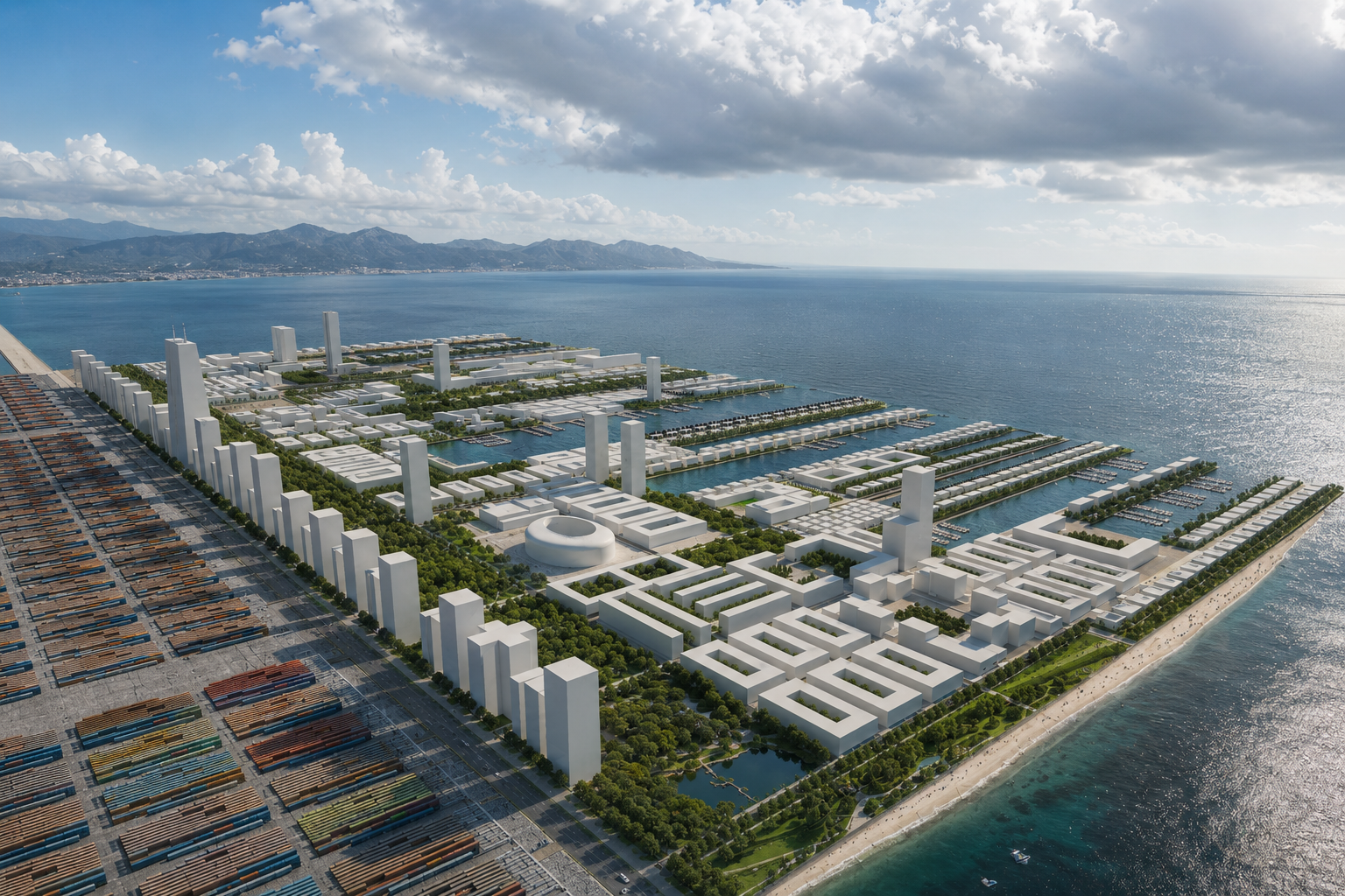
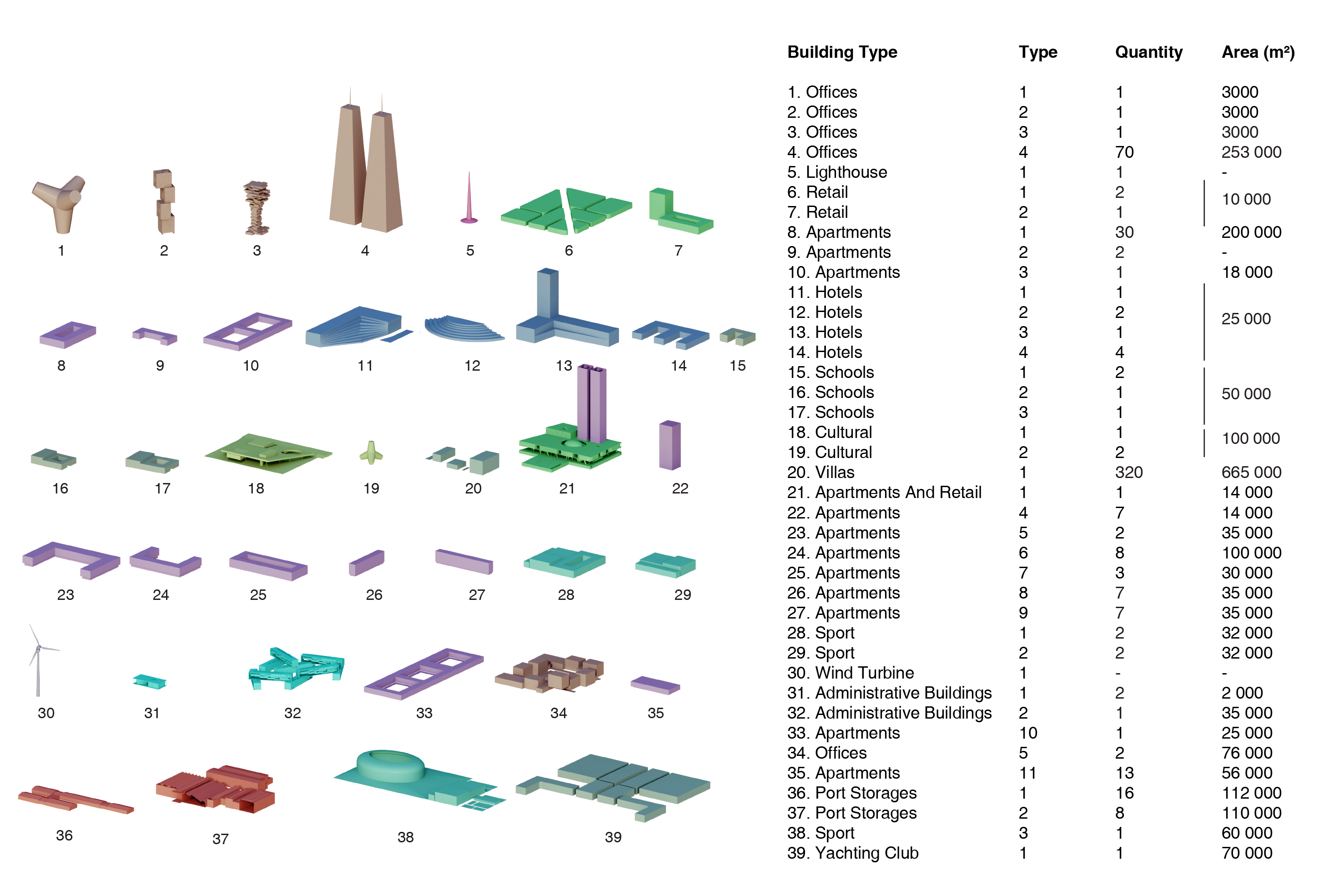
The interaction of the programme and the stage of the proposed building emerged based on a number of considerations: Primarily, the desire to create a first island of Georgia. Preserve the wet mainland with unique eco-system from construction. Create an International Port and fully functioning leisure city, both with expansion capacity. A focus has been given to introducing a modular platform 3x3km. Main transportation road and public park divide the patform in two equal parts city and port. Public park is positioned in the middle of the development thus creating a green hub between the city and the port becoming a centre of composition and the programme. The strip park can be expanded with the grouth of the city. Finger shaped residential and hotel area is designed as sea calming for yacht and small boat parking. Feiry terminals are located in those fingers for instant hotel and retail access. Overall height of the island is not exceeding ten strories, altough the office strip has no height limit thus can be designed for the market and client demand.